The Langness Peninsula provides a wealth of fascinating history and wildlife.
Langness means ‘Long Point’ and its southern most tip, Dreswick Point, is actually the southern most tip of the Isle of Man.
The promontory has seen mine workings, ship wrecks, gun batteries and several fortifications, as well as the first Derby horse race (in the 18th century) and more recently a golf course and hotel.
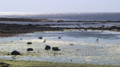
The side of the peninsula which borders Castletown Bay (to the south) has many rock pools when the tide is out and here you can see herons fishing or swallows flying low over the water catching insects. A wealth of other wading birds can be seen as well.
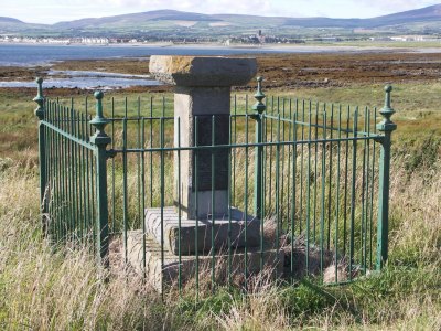
The road rises up to pass the haunting remains of Langness farmhouse. Opposite here is a small memorial to the Manx naturalist, Henry Madoc who was a Chief Constable of the Island and a keen ornithologist.
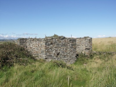
When you come to the car park you will see the remains of a small building on the left. This marks the spot of the Langness copper mine. Here there was a smithy and changing rooms for the miners. The mine went down 40 fathoms (240ft). The ore was crushed by machines bedded on concrete blocks which can still be seen nearby and it was hoisted from underground by machinery in the main building.
Looking from here towards the end of Langness you can see the silhouette of more buildings that were associated with copper trials.
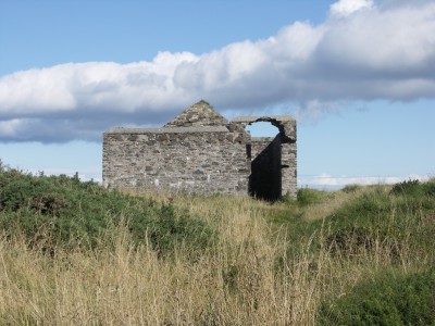
From the car park you can also see, in the centre of the peninsula, the remains of the dynamite store. This is a typical double-walled building, and most mines on the Island have one like it. The double wall offered some protection if the dynamite stored inside should explode.
One of the most interesting aspects of this side is the geology. Along from the car park, taking the right hand path close to the coast, you soon come across some strange arches on the beach below. It is possible to scramble down to these and explore them. The arches were actually formed relatively recently by the erosive power of the sea.
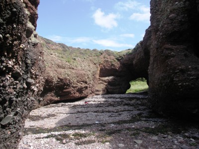
However, of greater significance to geologists is an ancient land surface known as an unconformity. The lower half of the arches are made up of what they call the Manx Group of rocks, formed around 480 million years ago, while the upper half is a type of gravel deposited by flash floods around 350 million years ago. The uneven surface separating these two rock types is what’s known as the unconformity and represents a gap in time of around 135 million years when no rocks have been preserved.
From the path here it is easy to see Langness Lighthouse. This was completed in 1880 after many requests from mariners and merchants stating that the peninsula presented a serious danger to shipping.
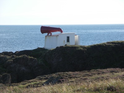
A foghorn was also provided which gave blasts of 8 seconds' duration with intervals of silence of 22 seconds. Although no longer used, the horn is still there. Like all other lighthouses around the British and Irish coasts, Langness is now automated.
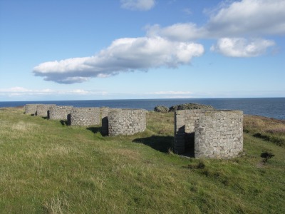
Near to the foghorn is a series of six, brick-built circular structures which were used during WWII. They are a Lewis gun training range and the guns were mounted on the brick walls.
Before there was a lighthouse, however, there was a tower. The romantic marker tower, popularly known as the Herring Tower, still stands and is an icon of the Langness peninsula.
It was built in 1811 by the British Government to act as a landmark for passing ships and is reputed to have been designed by Manx architect, Thomas Brine. Although there was no light on top, the tower would have been a useful landmark for passing vessels when, on a gloomy day, it would otherwise be difficult to get one’s bearings.
To learn more about the geology of this area, follow this link to the Manx Geological Survey: http://manxgeology.com/langness/
Don't forget to bookmark this page in case you want to view it again later.
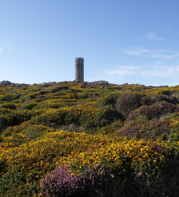
The Herring Tower, actually an early 19th century marker for ships.